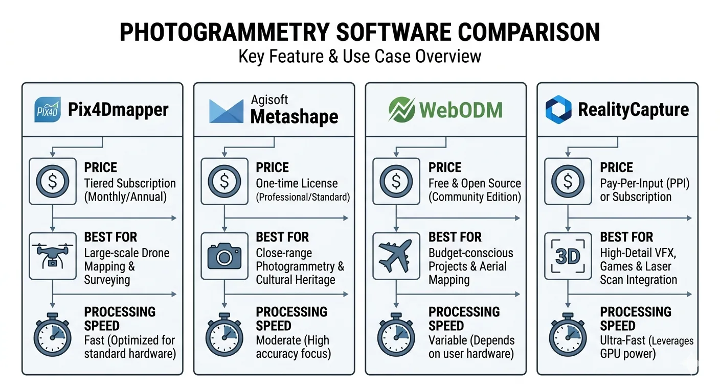


Featured Article
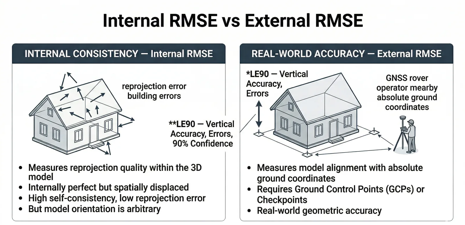
Survey Accuracy & GCPs
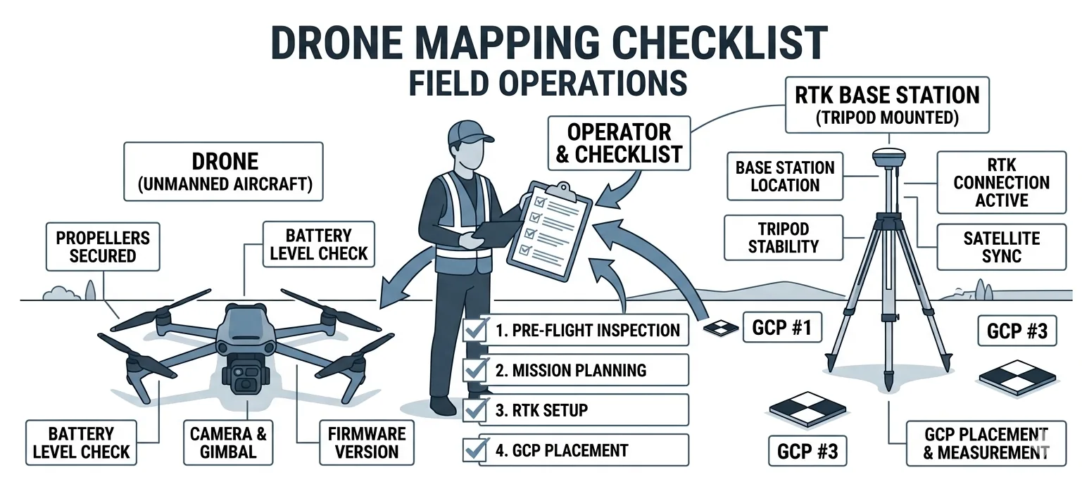
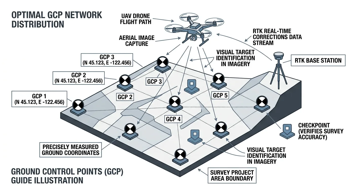
Ground Control Points for Drone Surveys: How Many, Where, and Why
How many ground control points does a drone survey need? 5 GCPs for under 5 acres, 8–12 for 50–500. Distribution beats density — and always include independent checkpoints.
Read more →