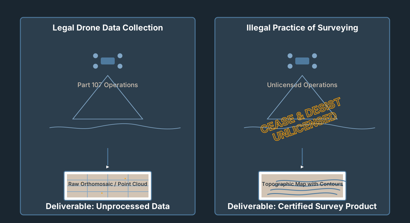
Aviation & Regulations
Drone Mapping Without a Surveyor License: What's Legal
Part 107 authorizes you to fly. It does not authorize you to survey. Where the line is, how states draw it, and how to operate legally in the gray zone.
Read more →


Tag Archive
36 articles on photogrammetry. Field-tested methodology from a GIS scientist with M.S. GIS, FAA Part 107, and 10+ years of geospatial work.
Part 107 authorizes you to fly. It does not authorize you to survey. Where the line is, how states draw it, and how to operate legally in the gray zone.
WebODM 3.2.8 adds DXF export for permanent overlays. OpenDroneMap's ODM 3.6.2 fixes a bug that could silently drop GPS telemetry. Two forks, one week — what shipped.

Build georeferenced NeRFs from drone imagery: RTK/PPK integration, COLMAP geo-registration, Nerfstudio, point cloud export, checkpoint validation.
How to pull the bare earth out of a 50-million-point drone photogrammetry cloud. The three tools compared: algorithm, workflow, cost, failure modes, and which one to pick.
Every ODM processing parameter explained: feature-quality, pc-quality, matcher-type, mesh-size, SMRF, orthophoto-resolution. Three usable presets.
WebODM install guide for Windows, Mac, Linux: Docker setup, first task, hardware requirements, common errors. Free photogrammetry on your hardware.
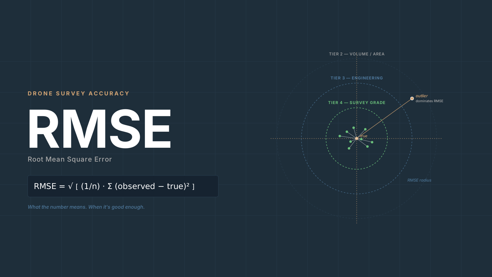
RMSE drone mapping explained: what the formula means, why vertical is always worse, CE90/LE90 conversions, NSSDA statements, when it's good enough.
Classify drone point clouds into ground/vegetation/buildings with Metashape, LAStools, PDAL, CloudCompare, ArcGIS Pro. Tool decision framework.
A practitioner's guide to Agisoft Metashape processing settings: what each quality slider controls, why the tradeoffs matter, and three presets for real jobs.
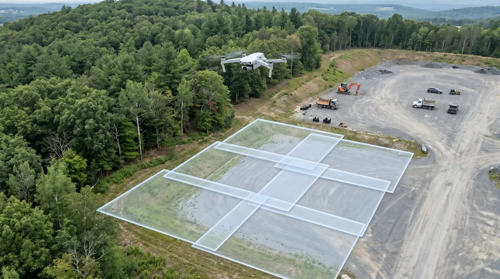
Image overlap drone mapping: 75/60 is the floor, not the target. Here's what fails when overlap is wrong and how to set photogrammetry overlap by job type.
In April 2026 WebODM forked the OpenDroneMap stack and renamed it — ODM became ODX, NodeODM became NodeODX. Which one you actually install, and why.
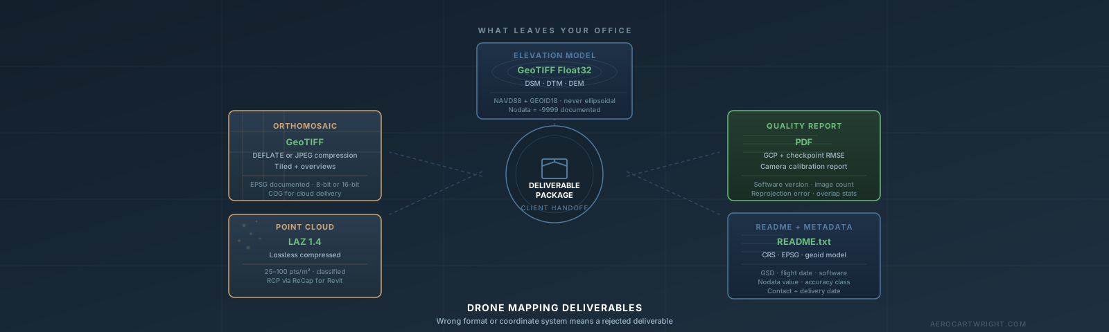
Orthomosaic export settings, point cloud formats, DEMs, coordinate systems — and how to package drone deliverables so clients can actually use them.
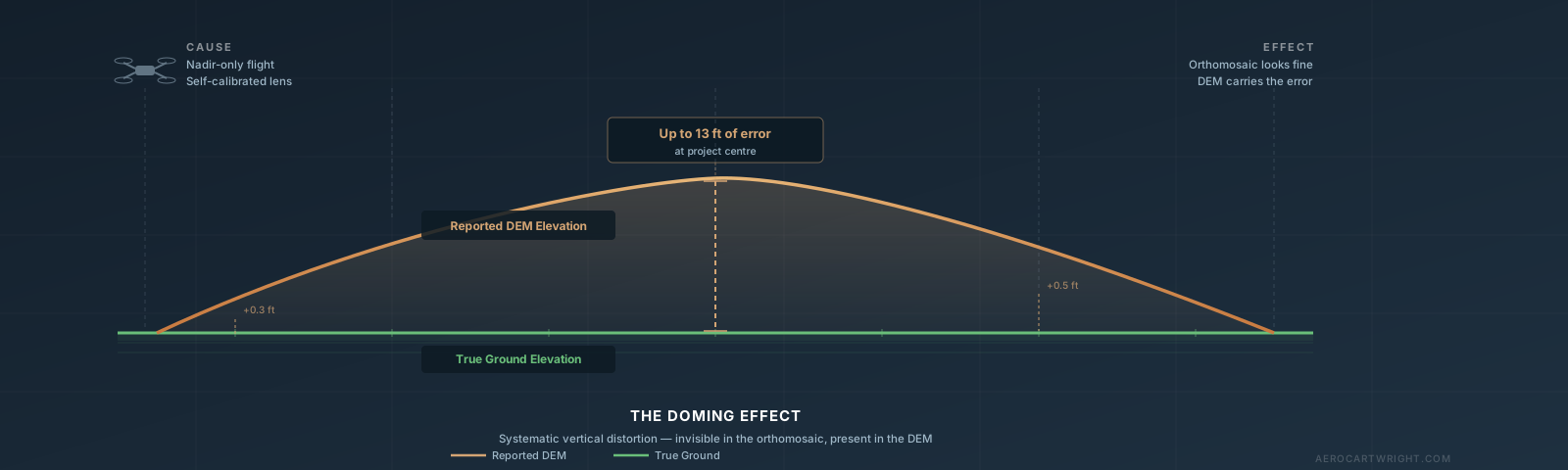
The drone map doming effect causes systematic elevation errors up to several feet — and the orthomosaic looks fine. Here's how to detect, fix, and prevent it.
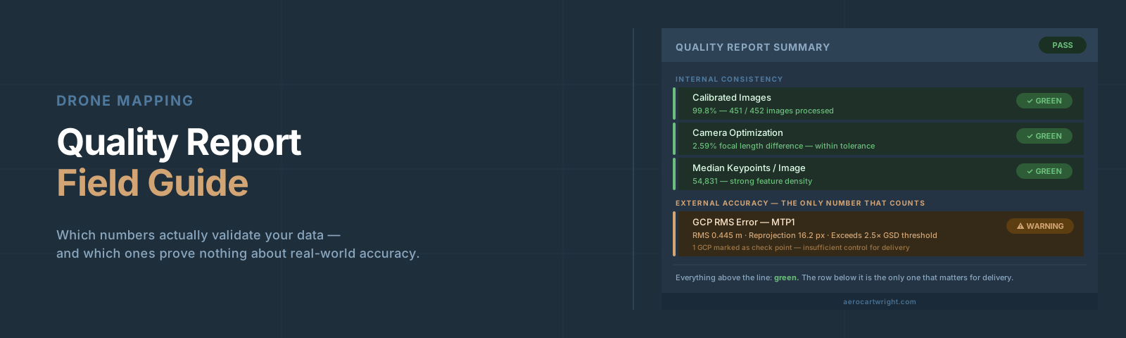
The drone mapping quality report looks reassuring — until a client finds 8-inch errors. Learn to read every Pix4D and Metashape number before delivery.
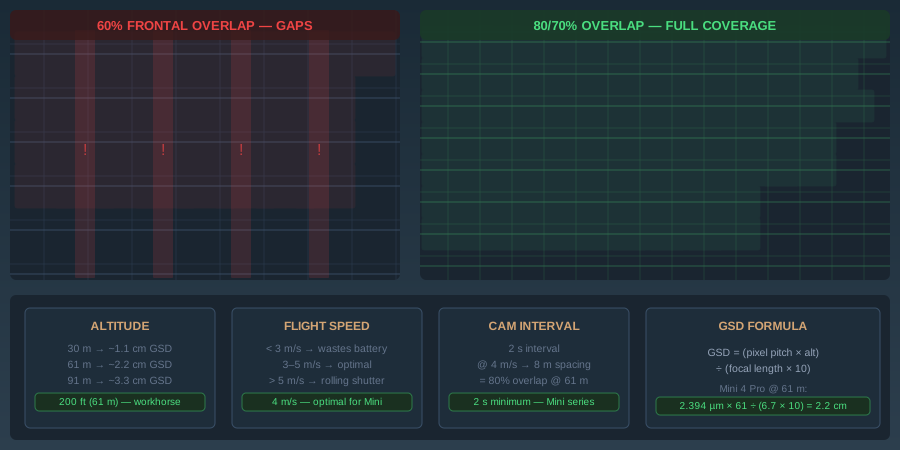
Drone mapping flight parameters: GSD, overlap, altitude, speed. 80% frontal / 70% side minimums. Accuracy improves 11x from 60% to 80% overlap.
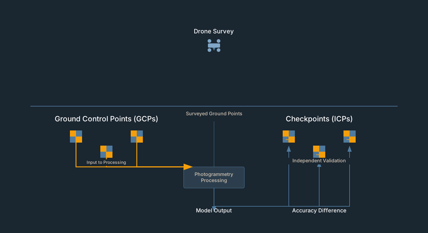
GCP residuals measure fit, not accuracy. Drone survey checkpoints provide independent validation. How to set them up in Pix4D, Metashape, WebODM.
Compare RealityScan, OpenDroneMap, Meshroom, and COLMAP for photogrammetry on Linux. Headless processing, Docker deployment, and which tool fits your workflow.
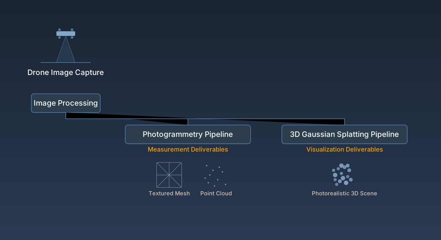
3D Gaussian Splatting for drone operators: vs photogrammetry, accuracy benchmarks, software and pricing, hybrid workflow, what it cannot do.
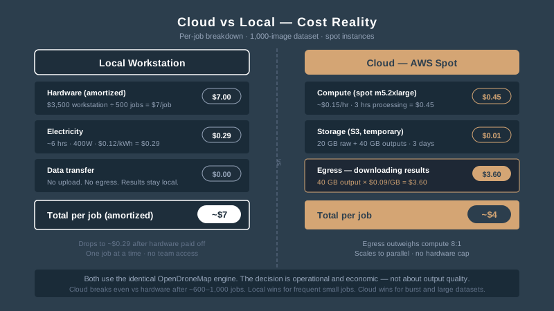
WebODM cloud vs local: AWS spot costs ($3-5/job), egress surprises, decision framework for when cloud wins vs when your workstation is better.
Confused by OpenDroneMap, WebODM, NodeODM and ClusterODM? Here's what each piece does, which you actually need, and how the free stack compares to Pix4D.
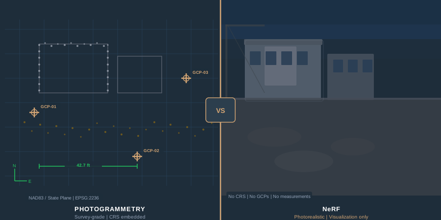
NeRF vs photogrammetry for drone mapping: accuracy numbers, output products, georeferencing limits, and a decision framework for when each wins.
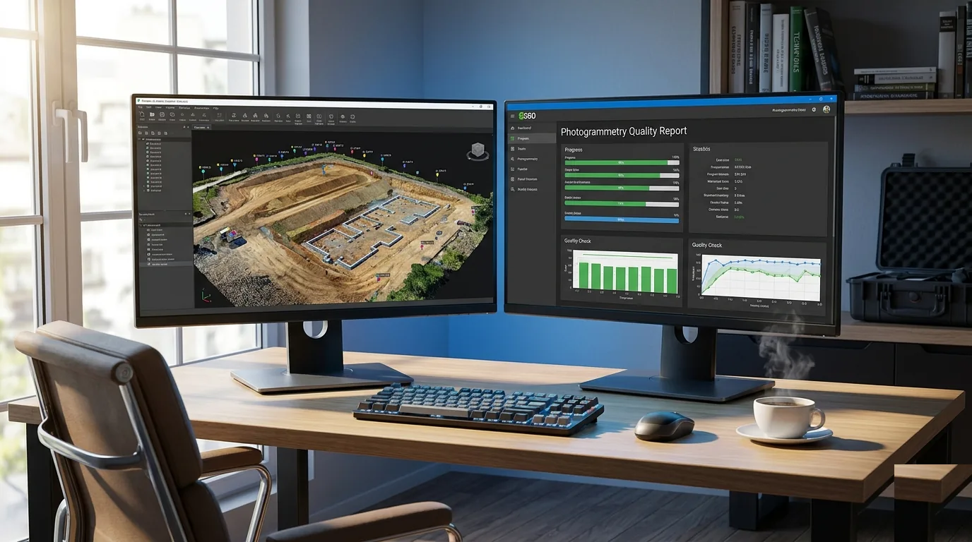
Drone processing checklist: CRS setup, alignment QA, GCP integration, checkpoint validation, quality report review. Prevents accuracy failures.
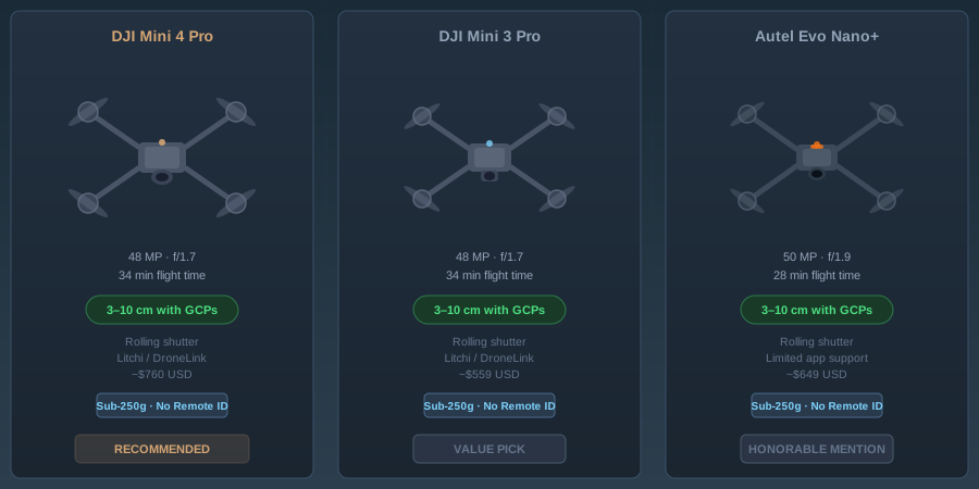
Consumer drone mapping buyer's guide: DJI Mini 4 Pro vs Mini 3 Pro vs Autel Evo Nano+. Accuracy, rolling shutter, GCP needs — field-tested verdicts.
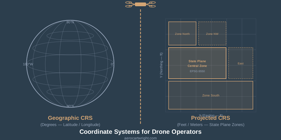
WGS84 vs NAD83, state plane, vertical datums — the CRS settings drone operators get wrong, and how to fix them in Metashape, Pix4D, and ODM.
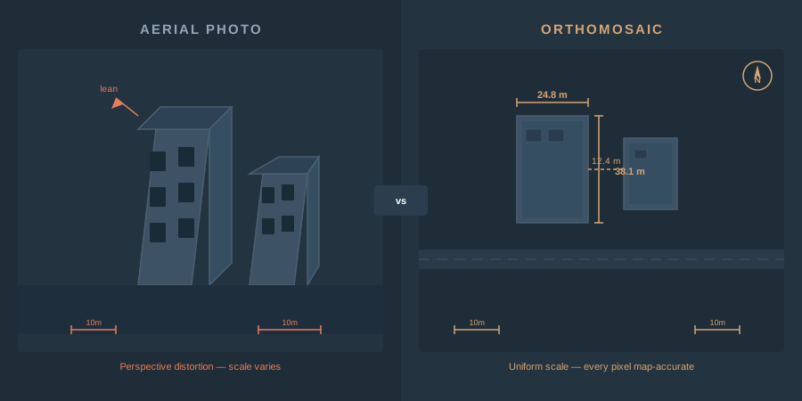
An orthomosaic is a georeferenced image mosaic built from overlapping drone photos. How photogrammetry creates one, GSD, GeoTIFF vs COG, GIS use.
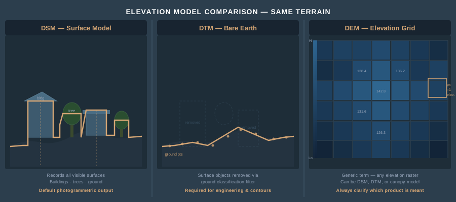
DSM vs DTM vs DEM for drone operators: definitions, how each is derived from photogrammetry, ground classification, and when each product is required.
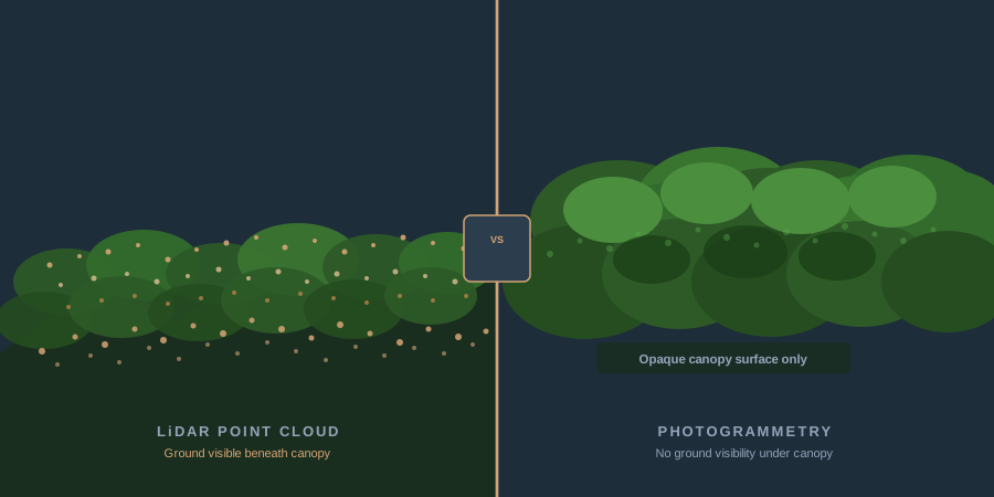
LiDAR vs photogrammetry for drone surveys: real accuracy numbers, hardware costs, processing workflows, and a decision framework — when each technology wins, and when it doesn't.
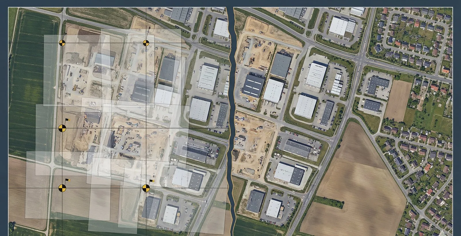
WebODM split from the OpenDroneMap nonprofit on April 6, 2026. What changed, why, and migration steps — new GitHub URLs, Docker images, docs.
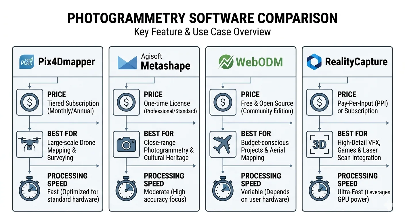
RealityCapture vs Agisoft Metashape vs Pix4D vs WebODM — pricing, speed, accuracy, and GCP workflow compared, and which one wins for survey-grade work in 2026.
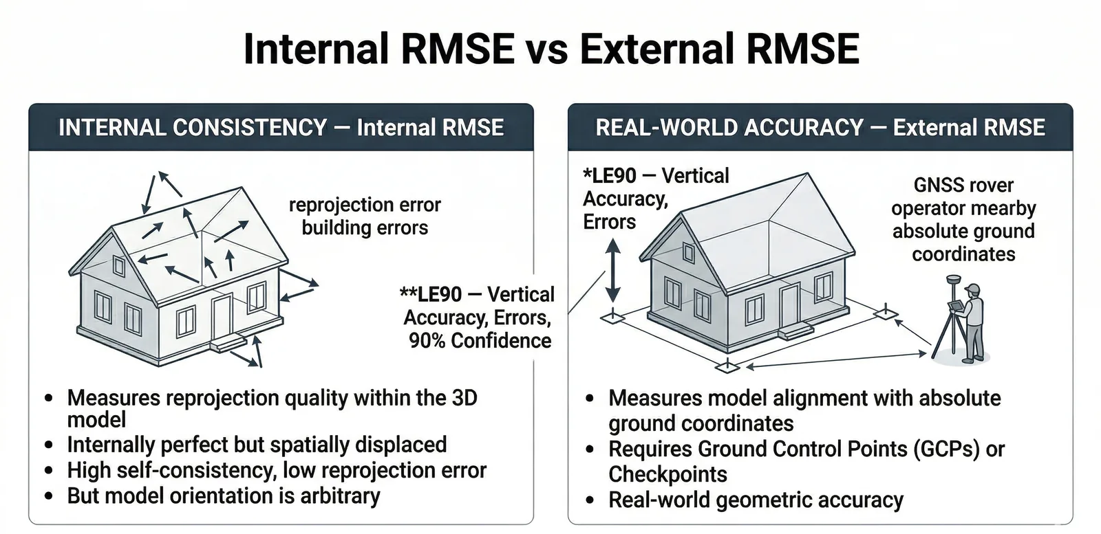
Real drone survey accuracy in 2026: ±2–5 cm horizontal, ±3–12 cm vertical typical. RMSE vs CE90 vs LE90 explained, ASPRS classes, 5 red flags in any quality report.
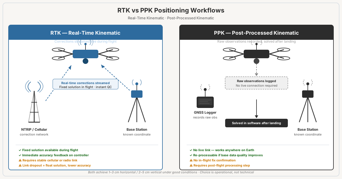
RTK vs PPK for drone surveys: both hit 1-3cm accuracy. RTK corrects in real time, PPK processes post-flight. Failure modes, costs, when to use each.
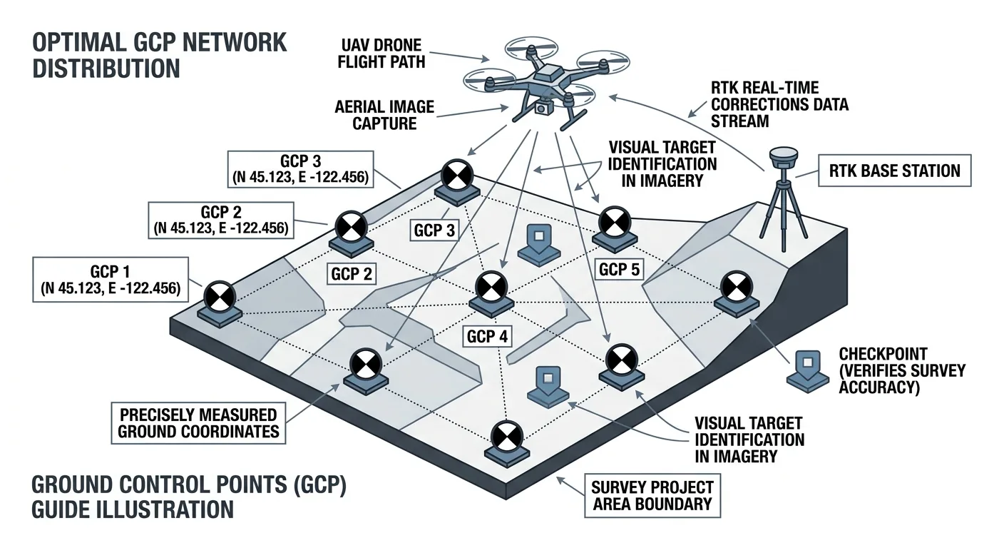
How many ground control points does a drone survey need? 5 GCPs for under 5 acres, 8–12 for 50–500. Distribution beats density — and always include independent checkpoints.
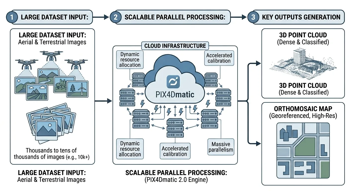
PIX4Dmatic 2.0 absorbs PIX4Dsurvey into three tiers. Full comparison vs Metashape and DJI Terra on price, accuracy, GCP workflows, and deliverables.
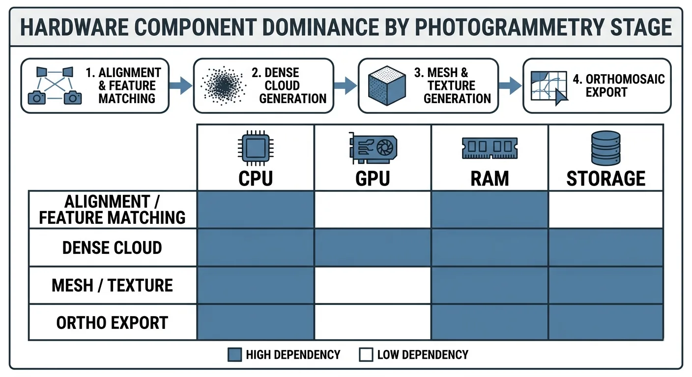
Drone mapping hardware guide: CPU, GPU, RAM, NVMe requirements for photogrammetry. Workstation builds by project size and processing software.
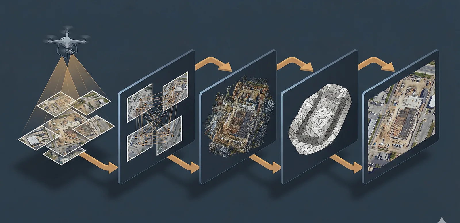
Drone data explained: imagery, orthomosaics, point clouds, elevation models, 3D meshes. How photogrammetry turns photos into geospatial products.
AeroCartwright: drone mapping education and geospatial tools from a working GIS professional with firefighting, academic, and federal field experience.
Free download: The Complete Drone Mapping Workflow Guide — 30+ pages of field-tested methodology.
Technical content only. Unsubscribe anytime.