Drone Mapping · Photogrammetry · LiDAR · GIS

Drone mapping, explained by a geospatial specialist.

The complete workflow — from flight planning to professional geospatial deliverables.

Survey Accuracy & GCPs

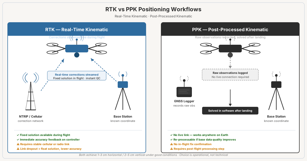
RTK vs PPK Drone Mapping: Which Should You Use?

RTK vs PPK for drone surveys: both hit 1-3cm accuracy. RTK corrects in real time, PPK processes post-flight. Failure modes, costs, when to use each.

Read more →
Drone Hardware

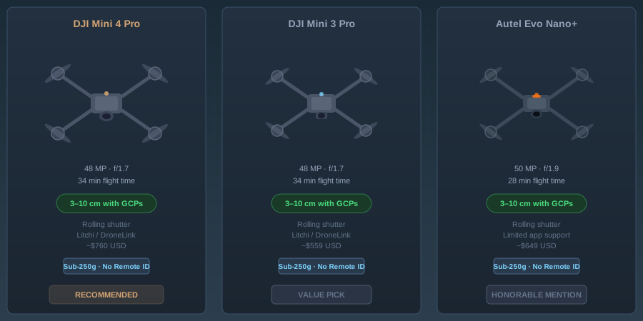
Best Consumer Drones for Mapping in 2026

Consumer drone mapping buyer's guide: DJI Mini 4 Pro vs Mini 3 Pro vs Autel Evo Nano+. Accuracy, rolling shutter, GCP needs — field-tested verdicts.

Read more →

Recent

· Technology

AI-Assisted Point Cloud Processing: What Actually Works in 2026

Compare AI point cloud processing tools: Pix4D, Metashape, OpenPointClass. Real accuracy benchmarks, workflows, and which saves time in practice.

· Aviation & Regulations

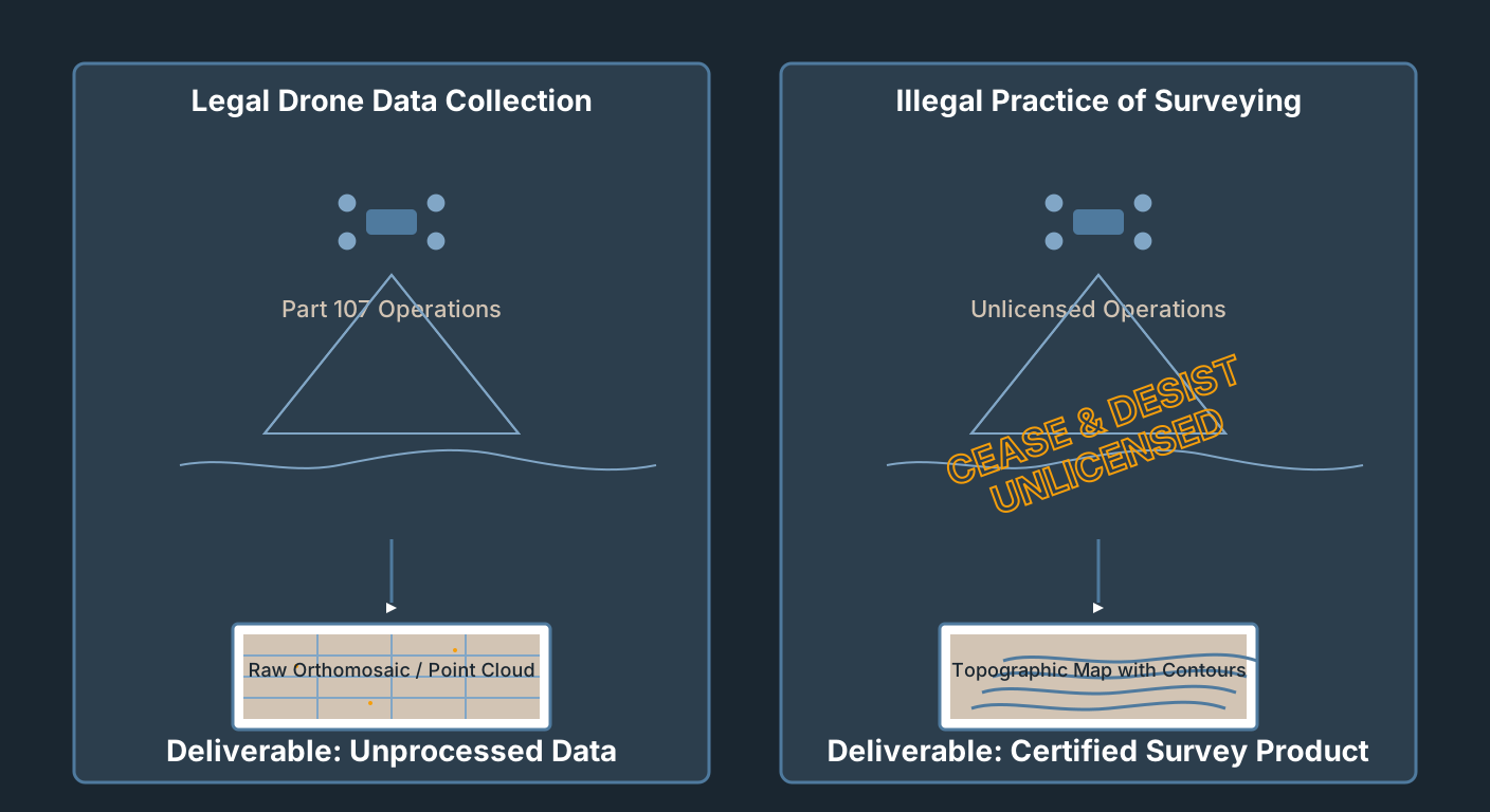
Drone Mapping Without a Surveyor License: What's Legal

Part 107 authorizes you to fly. It does not authorize you to survey. Where the line is, how states draw it, and how to operate legally in the gray zone.

· ODM Cloud

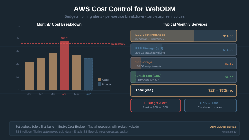
Reading Your First AWS Bill (Don't Panic)

Your first AWS bill says $47.23 when you expected $2. What happened, why egress dominates, and three simple practices to prevent bill shock.

· Survey Accuracy & GCPs

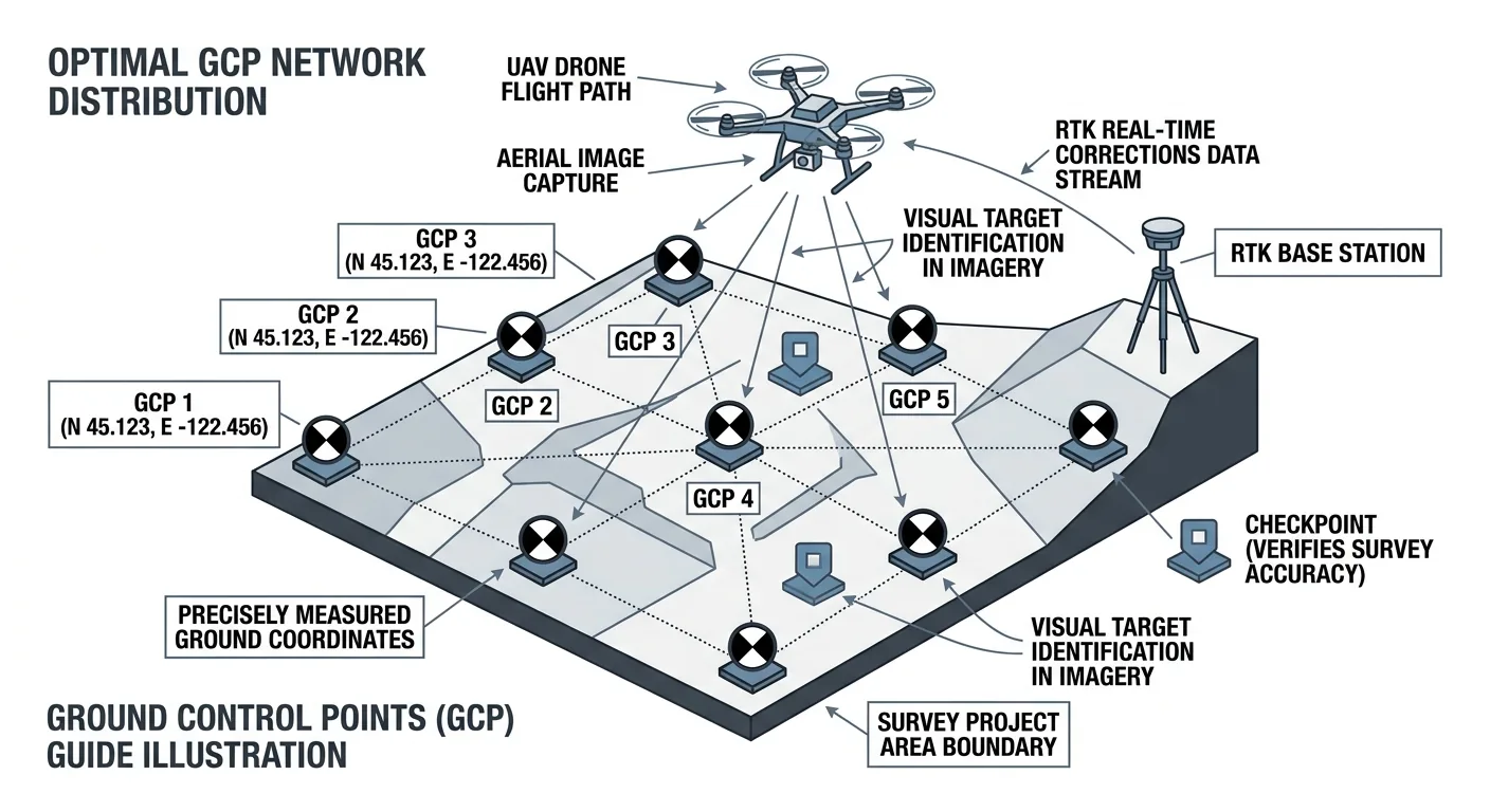
Why Your RTK Drone Still Needs GCPs (And When You Can Skip Them)

RTK alone produces 2–5 cm horizontal but 5–15 cm vertical bias. Why GCPs still matter, when checkpoint-only works, and the bowling/doming failure mode.

· Software & Processing

WebODM 3.2.8 and ODM 3.6.2: What Actually Shipped in August 2026

WebODM 3.2.8 adds DXF export for permanent overlays. OpenDroneMap's ODM 3.6.2 fixes a bug that could silently drop GPS telemetry. Two forks, one week — what shipped.

· Consumer Drone Mapping

Drone Mapping vs. Land Surveying: Where the Legal Lines Are

FAA regulates the flight, states regulate the data. Learn where drone mapping crosses into surveying law, which states enforce, and the safe business model.

Frequently Asked

How accurate is drone mapping?

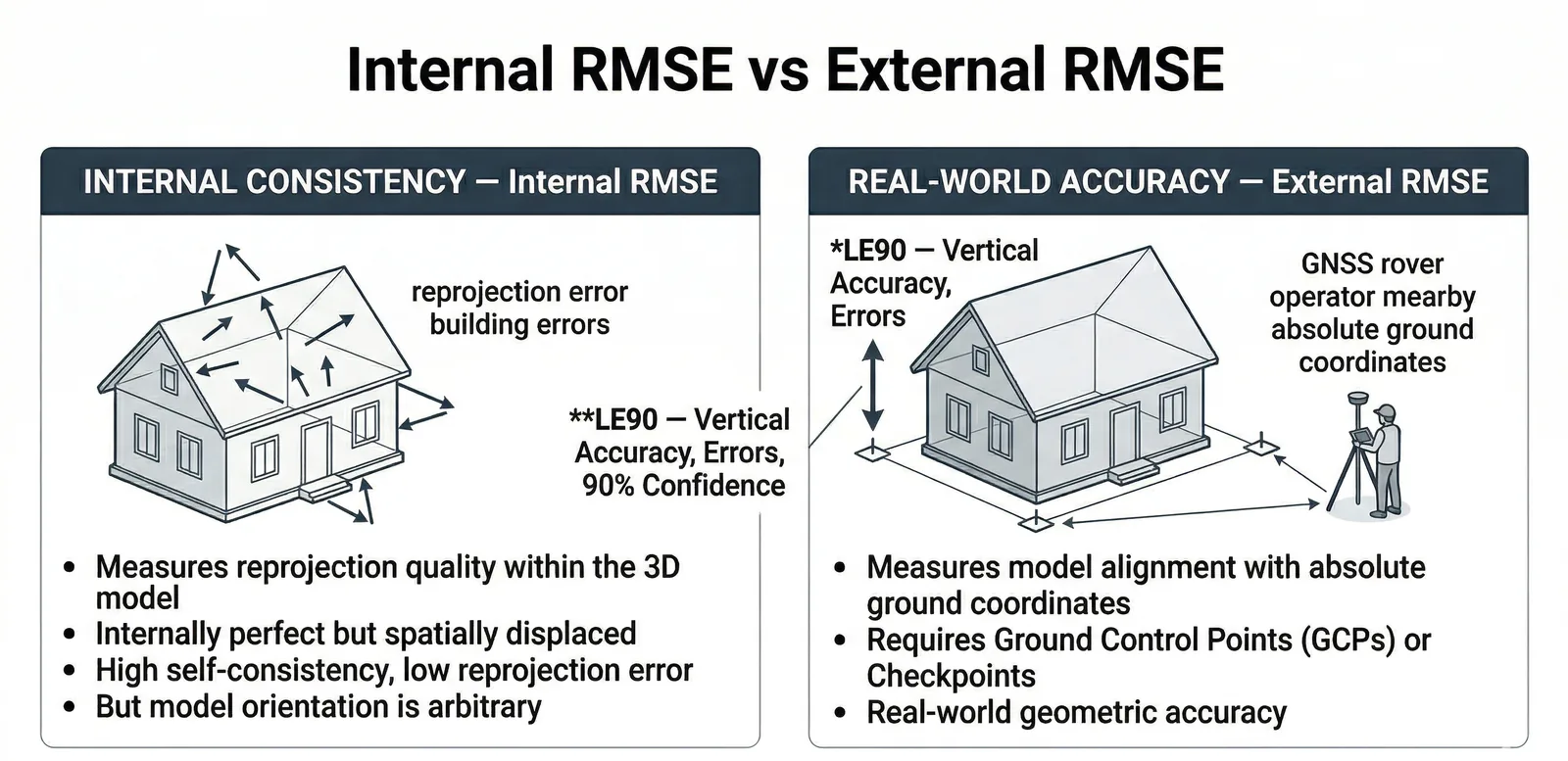
A well-executed drone survey delivers 2–5 cm horizontal accuracy with proper ground control. Vertical accuracy typically runs 2–3× worse than horizontal on nadir-only flights — adding an oblique pass closes most of that gap. The number that matters is checkpoint RMSE against independent surveyed points, not the GCP RMSE your software reports.

Read the full accuracy guide →

Do I need ground control points?

It depends on the accuracy class your project requires. Direct RTK/PPK without GCPs reaches 2–5 cm horizontal under ideal conditions, but vertical bias and doming can blow up without independent control. For any engineering, construction, or formal accuracy claim, GCPs plus independent checkpoints are not optional.

GCP placement and count guide →

RTK or PPK — which should I use?

Both achieve comparable real-world accuracy when configured correctly. RTK gives real-time corrections in the field; PPK processes everything after the flight. PPK is more forgiving on remote or RF-noisy sites; RTK is faster when you have a reliable correction stream.

RTK vs PPK decision framework →

Which photogrammetry software should I use?

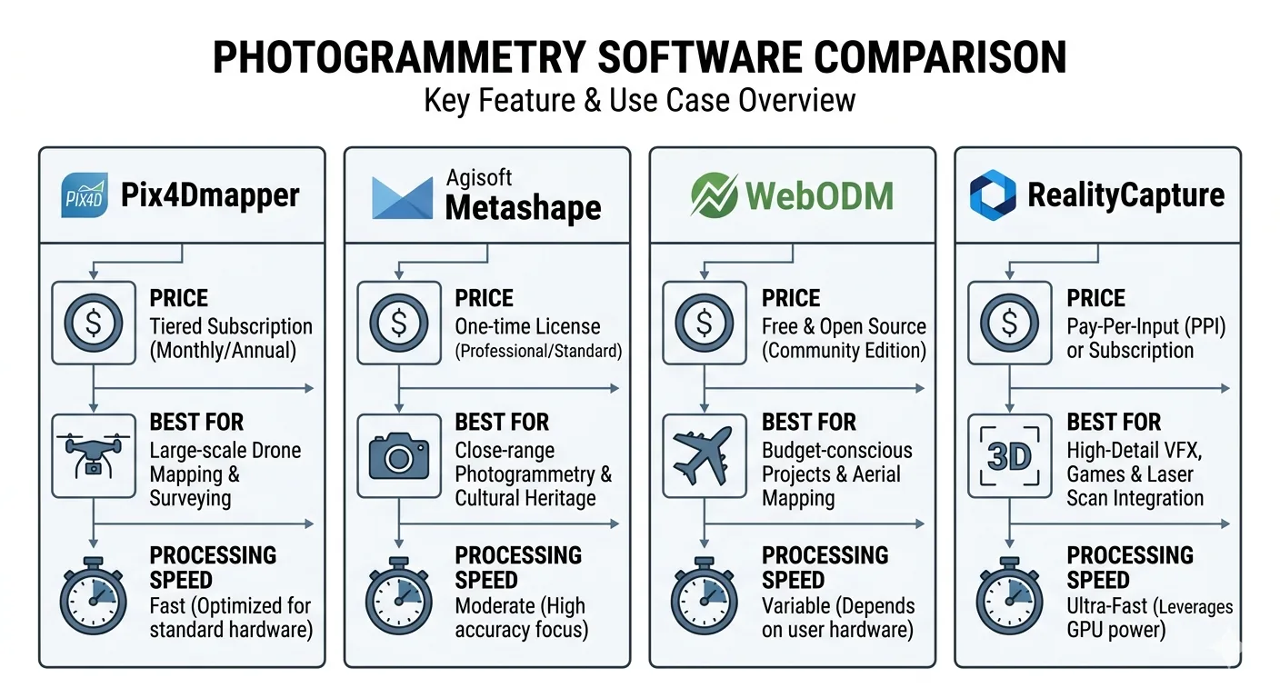
Pix4D, Agisoft Metashape, WebODM, and RealityCapture each fit a different price point and workflow. WebODM is free and capable but needs hardware investment. Metashape is the most flexible for high-accuracy work. Pix4D excels at surveying templates. RealityCapture is fastest for very large datasets.

Vendor-neutral software comparison →

What is the best drone for mapping?

For commercial work, a DJI Mavic 3 Enterprise or Phantom 4 RTK remains the practical default. For learning, side projects, and accuracy-tolerant work, a DJI Mini 4 Pro with proper GCPs delivers surprisingly good results — typically ±4–12 inches with disciplined workflow.

Consumer drone mapping buyer's guide →

Colophon

Written by Eric — M.S. GIS, FAA Part 107, ten-plus years of geospatial work before drones were the interesting part of the job. Topics: photogrammetry, LiDAR, GCPs, RTK/PPK, coordinate systems, the software stack, and the parts of fieldwork that determine whether the deliverable holds up.

No sponsored posts. Vendor-neutral by default.

More about Eric →