Why Your Drone Map Looks Warped: The Doming Effect Explained
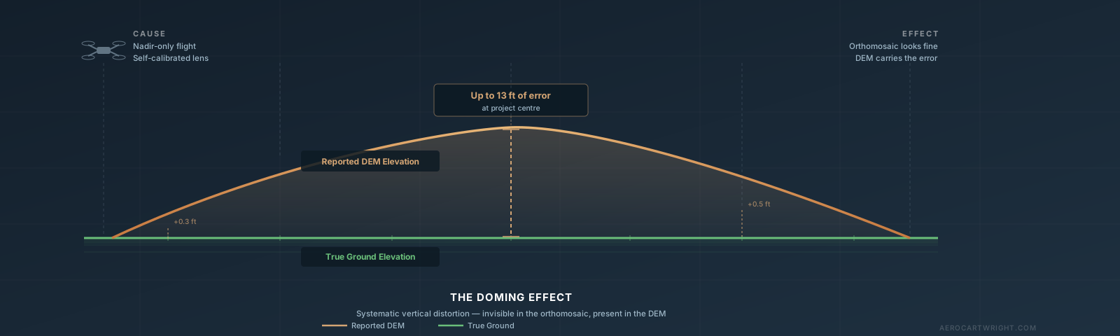
The drone map doming effect causes systematic elevation errors up to 13 ft — and the orthomosaic looks fine. Here's how to detect, fix, and prevent it.
Tag Archive
3 articles on survey. Field-tested methodology from a GIS scientist with M.S. GIS, FAA Part 107, and 10+ years of geospatial work.
The drone map doming effect causes systematic elevation errors up to 13 ft — and the orthomosaic looks fine. Here's how to detect, fix, and prevent it.
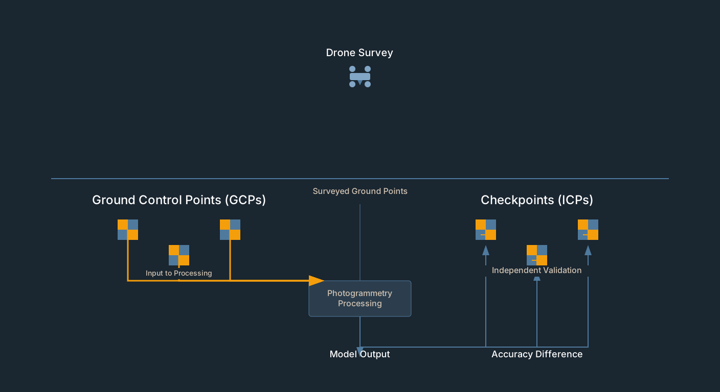
GCP residuals measure fit, not accuracy. Drone survey checkpoints provide independent validation. How to set them up in Pix4D, Metashape, WebODM.
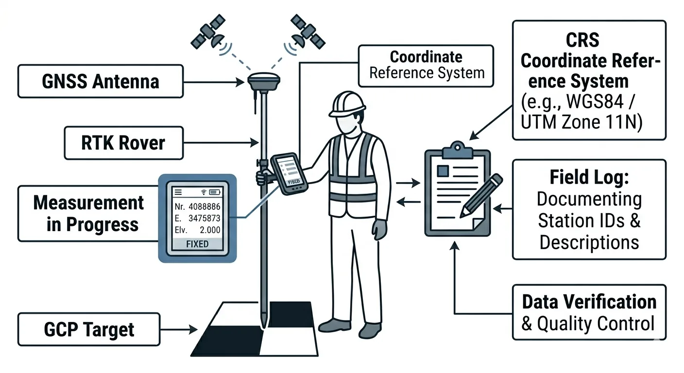
GCP deployment checklist: placement, measurement procedure, photo documentation, field logging. Every step from planning through pre-flight.
Free download: The Complete Drone Mapping Workflow Guide — 30+ pages of field-tested methodology.
Technical content only. Unsubscribe anytime.