Technology
AI-Assisted Point Cloud Processing: What Actually Works in 2026
Compare AI point cloud processing tools: Pix4D, Metashape, OpenPointClass. Real accuracy benchmarks, workflows, and which saves time in practice.
Read more →


Tag Archive
10 articles on point cloud. Field-tested methodology from a GIS scientist with M.S. GIS, FAA Part 107, and 10+ years of geospatial work.
Compare AI point cloud processing tools: Pix4D, Metashape, OpenPointClass. Real accuracy benchmarks, workflows, and which saves time in practice.

Build georeferenced NeRFs from drone imagery: RTK/PPK integration, COLMAP geo-registration, Nerfstudio, point cloud export, checkpoint validation.
How to pull the bare earth out of a 50-million-point drone photogrammetry cloud. The three tools compared: algorithm, workflow, cost, failure modes, and which one to pick.
Every WebODM/ODX processing parameter explained: feature-quality, pc-quality, matcher-type, mesh-size, SMRF, orthophoto-resolution. Three usable presets.

A practitioner's guide to Agisoft Metashape processing settings: what each quality slider controls, why the tradeoffs matter, and three presets for real jobs.

Drone data in ArcGIS Pro: import orthomosaics, point clouds, DSMs. Workflow to volume calculations, contours, and ArcGIS Online delivery.

NeRF vs photogrammetry for drone mapping: accuracy numbers, output products, georeferencing limits, and a decision framework for when each wins.

Complete QGIS workflow for drone data: import orthomosaics, build pyramids, contours from DEMs, point clouds, QField field review. QGIS 3.44 LTR.

LiDAR vs photogrammetry for drone surveys: real accuracy numbers, hardware costs, processing workflows, and a decision framework — when each technology wins, and when it doesn't.
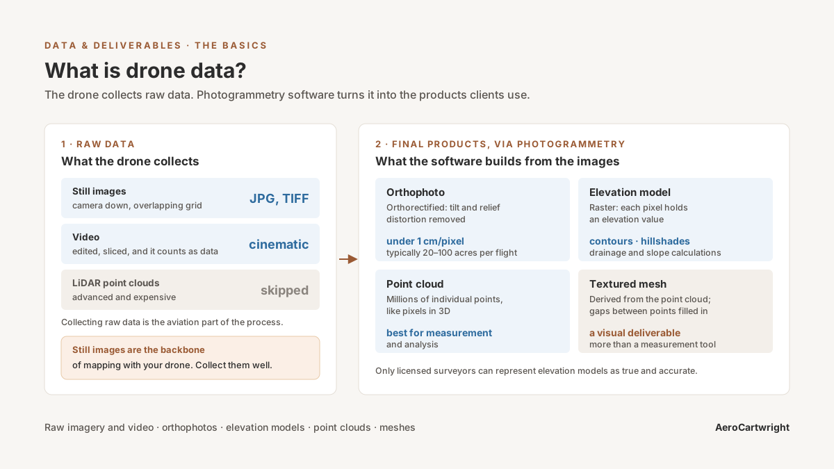
Drone data explained: imagery, orthomosaics, point clouds, elevation models, 3D meshes. How photogrammetry turns photos into geospatial products.
Free download: The Complete Drone Mapping Workflow Guide — 30+ pages of field-tested methodology.
Technical content only. Unsubscribe anytime.