
Stockpile Volumes: Why LiDAR Doesn't Pay on Aggregate Work
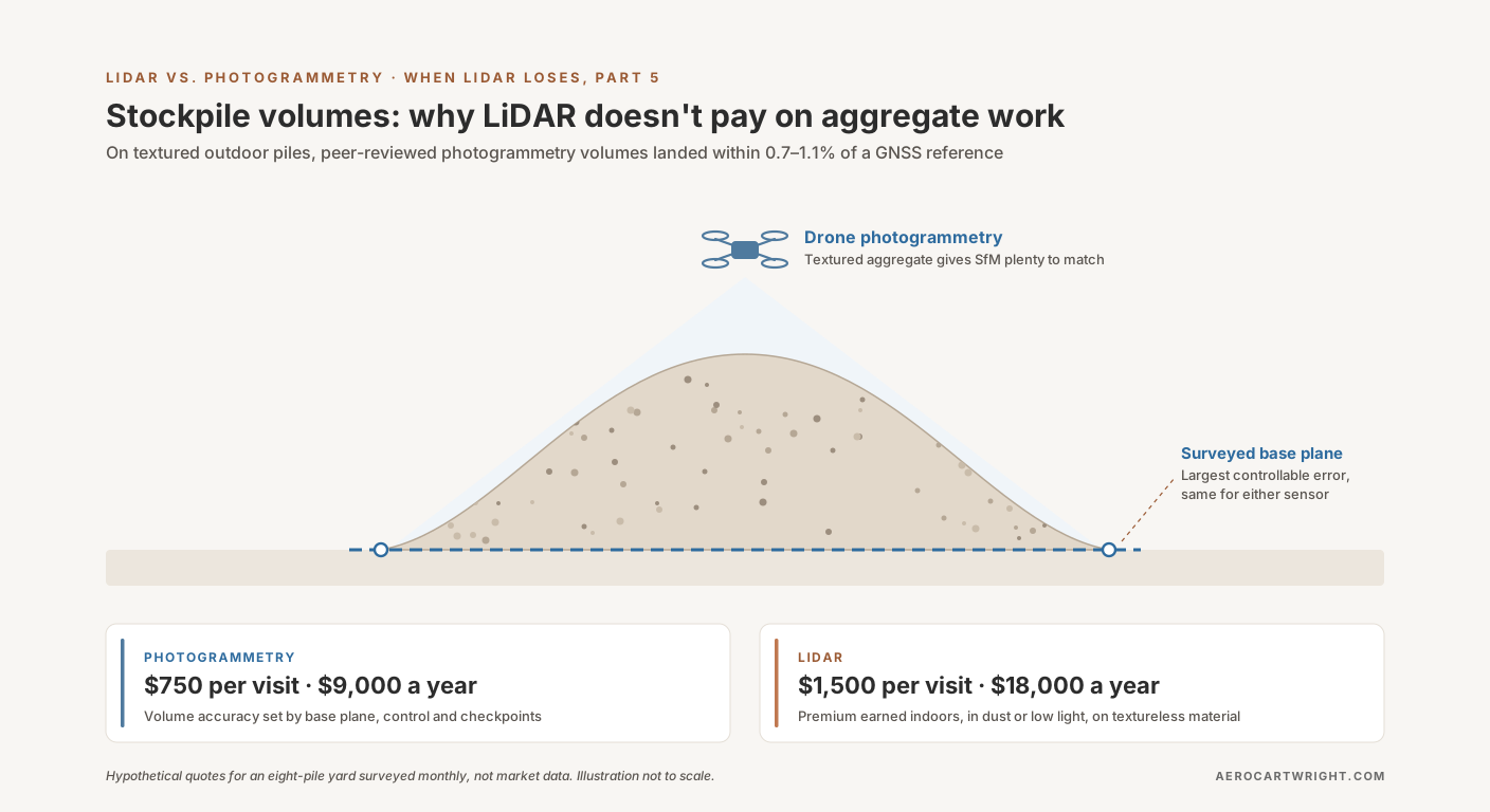
Aggregate stockpiles are textured and outdoor — where peer-reviewed photogrammetry studies landed within 0.7–1.1% of a GNSS reference volume. When the LiDAR premium isn't earning its keep.
Tag Archive
5 articles on LiDAR. Field-tested methodology from a GIS scientist with M.S. GIS, FAA Part 107, and 10+ years of geospatial work.
Aggregate stockpiles are textured and outdoor — where peer-reviewed photogrammetry studies landed within 0.7–1.1% of a GNSS reference volume. When the LiDAR premium isn't earning its keep.
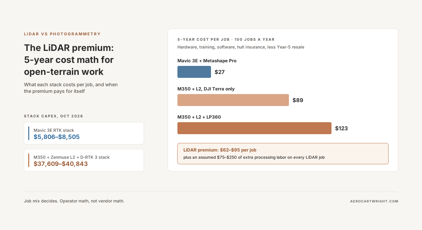
Mavic 3E stack (~$5.8K-8.5K) vs M350+L2 (~$37.6K-40.8K) at October 2026 dealer prices: the per-job cost over 5 years, when the LiDAR premium pays off, and when you're paying for hype.
The FCC's retroactive DJI ban proposal is still undecided; a separate DJI/Autel parts rule starts Oct. 13. What each means for LiDAR rigs and mapping fleets.
How to pull the bare earth out of a 50-million-point drone photogrammetry cloud. The three tools compared: algorithm, workflow, cost, failure modes, and which one to pick.
LiDAR vs photogrammetry for drone surveys: real accuracy numbers, hardware costs, processing workflows, and a decision framework — when each technology wins, and when it doesn't.
Free download: The Complete Drone Mapping Workflow Guide — 30+ pages of field-tested methodology.
Technical content only. Unsubscribe anytime.