
LiDAR vs Photogrammetry
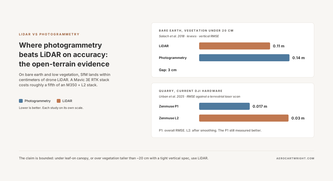
Where Photogrammetry Beats LiDAR: Open-Terrain Accuracy
Peer-reviewed studies show SfM photogrammetry landing within a few centimeters of UAV LiDAR vertical accuracy on bare earth, with roughly a fifth of the hardware capex. The studies, the numbers, and where the claim breaks down.
Read more →