
Coded GCP Targets for Drone Mapping: AprilTag, ArUco, AeroPoints, SkyHigh Bullseye, and DIY
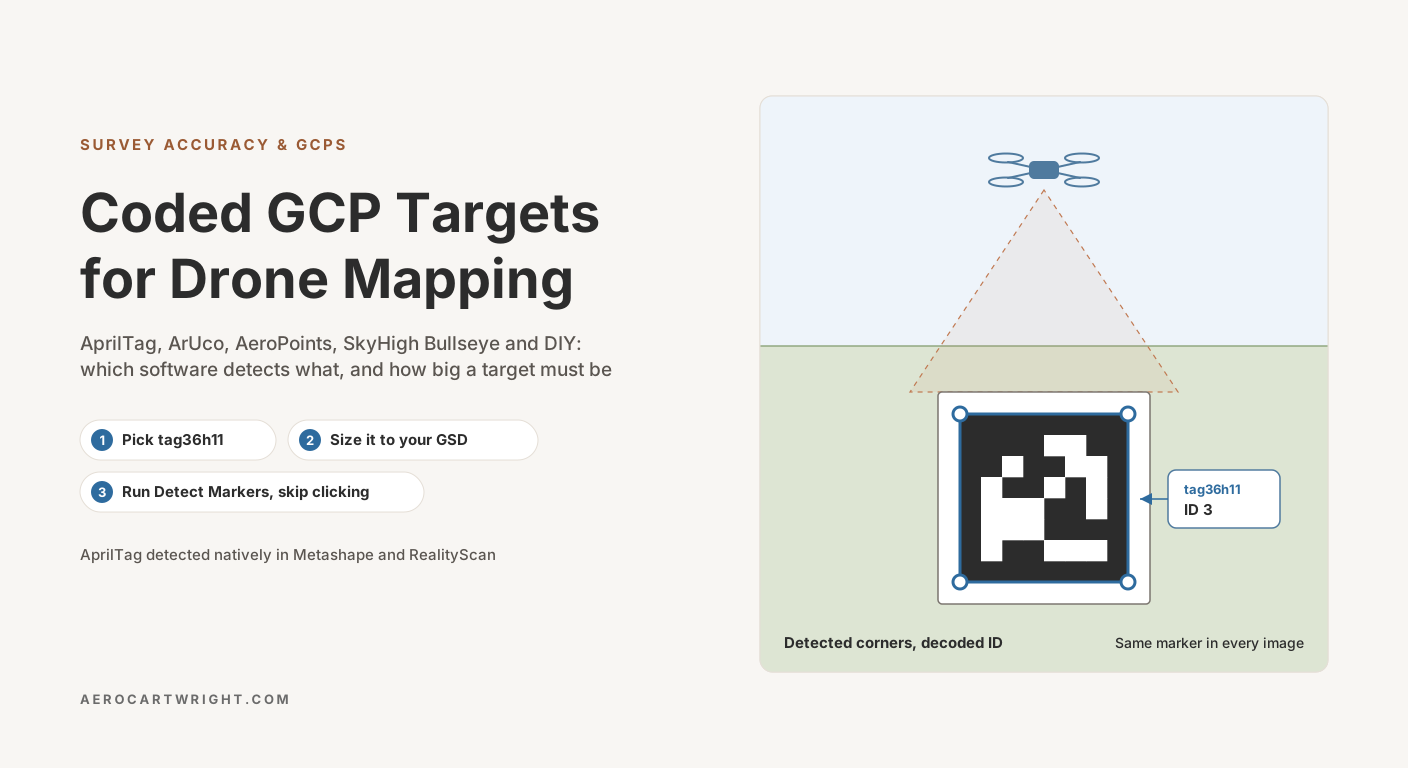
AprilTag GCP targets Metashape and RealityScan auto-detect, the Pix4D and AeroPoint targets Pix4D AutoGCP reads, ArUco vs commercial pads, and target sizing.
Tag Archive
4 articles on ground control points. Field-tested methodology from a GIS scientist with M.S. GIS, FAA Part 107, and 10+ years of geospatial work.
AprilTag GCP targets Metashape and RealityScan auto-detect, the Pix4D and AeroPoint targets Pix4D AutoGCP reads, ArUco vs commercial pads, and target sizing.
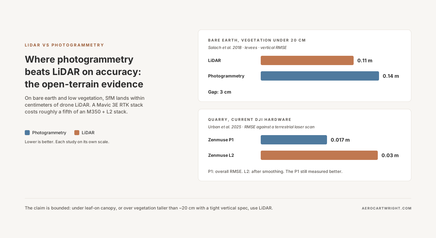
Peer-reviewed studies show SfM photogrammetry landing within a few centimeters of UAV LiDAR vertical accuracy on bare earth, with roughly a fifth of the hardware capex. The studies, the numbers, and where the claim breaks down.
RTK alone produces 2–5 cm horizontal but 5–15 cm vertical bias. Why GCPs still matter, when checkpoint-only works, and the bowling/doming failure mode.
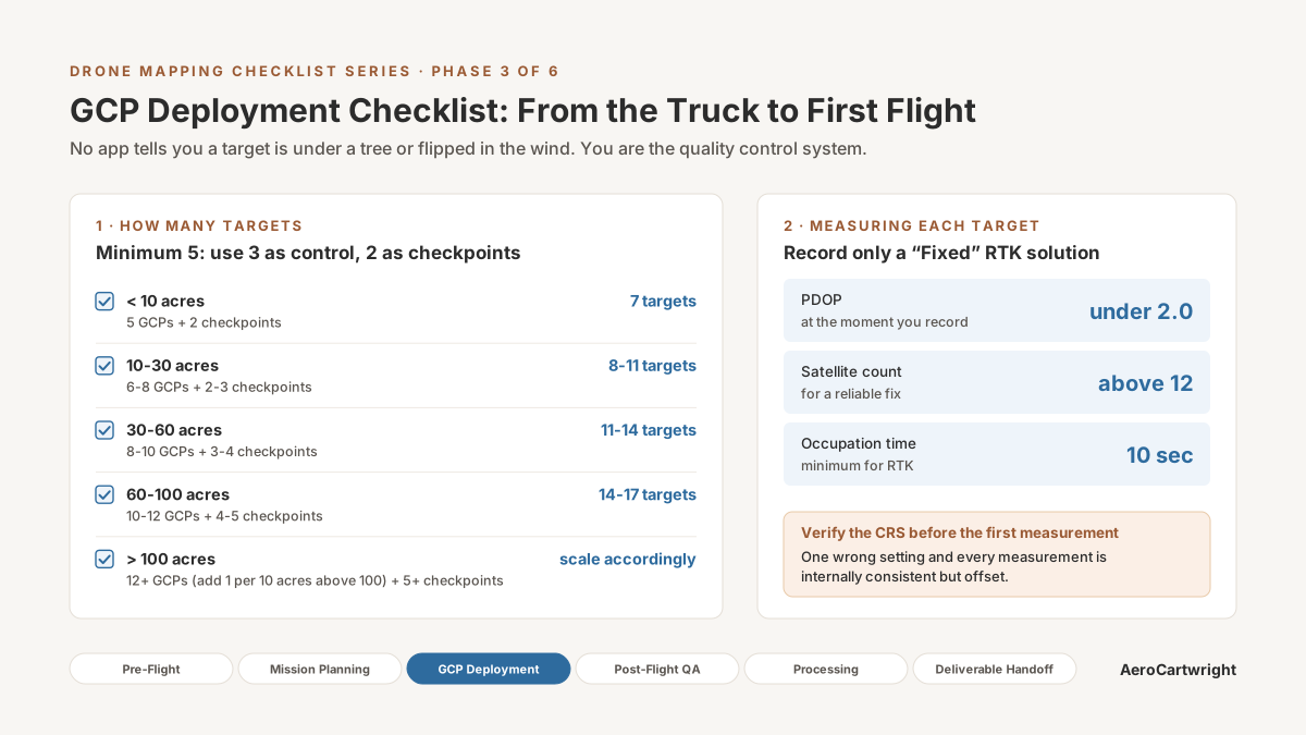
GCP deployment checklist: placement, measurement procedure, photo documentation, field logging. Every step from planning through pre-flight.
Free download: The Complete Drone Mapping Workflow Guide — 30+ pages of field-tested methodology.
Technical content only. Unsubscribe anytime.