
Last month a contractor called me about a 40-acre grading verification project. He’d hired a drone operator who set 12 ground control points, surveyed each one with a rover, flew an RTK drone, post-processed with checkpoints, and delivered a surface model accurate to 0.8 inches vertical. Professional work. Also $4,200 and two full field days.
The project spec? Confirm rough grading to within 0.3 feet of design. That’s 3.6 inches. A single RTK flight with zero GCPs would have hit that tolerance in three hours for under $800.
The operator didn’t do anything wrong technically. He did the wrong tier of work for the project. And he’s not alone — most drone mapping content treats ground control points as mandatory for every job. They’re not. Positioning accuracy is a spectrum, and the professional move is matching your tier to the project requirement. Not over-engineering. Not under-delivering.
Here’s the framework.
The 4 Tiers of Drone Survey Positioning
Every drone survey falls into one of four positioning tiers. Each tier has a cost, a time footprint, and an accuracy ceiling. The goal is to pick the lowest tier that meets or exceeds the project specification.
| Tier | Method | Typical Accuracy | Field Time (40 acres) | Approximate Cost per Job |
|---|---|---|---|---|
| 1 | Consumer GPS only | 3–10 ft (1–3 m) | 1–2 hours | $200–$500 |
| 2 | RTK/PPK, no GCPs | 1–2 in (2.5–5 cm) | 2–3 hours | $500–$1,200 |
| 3 | GCPs with survey-grade measurement | 0.5–1 in (1–3 cm) | 4–6 hours | $1,500–$3,000 |
| 4 | RTK/PPK + GCPs + independent checkpoints | Sub-inch, defensible | 6–8 hours | $2,500–$5,000+ |
Those cost estimates assume a single operator with existing equipment. Your numbers will vary by region, but the ratios hold.

Tier 1: Consumer GPS Only (3–10 ft)
Your drone’s built-in GNSS receiver — the one that ships with every DJI Mini, Air, or Mavic consumer platform — geotags images using single-frequency, code-based positioning. No corrections. No differential computation. Just raw satellite fixes.
Accuracy: 1 to 3 meters horizontal, 3 to 5 meters vertical on a clear day with good satellite geometry. On a bad day — urban canyon, tree canopy, or poor constellation visibility — you’ll see 5 to 10 meters. The images are internally consistent (relative accuracy is fine for photogrammetry), but the entire model floats in geographic space by whatever error the GPS receiver introduced.
When Tier 1 is enough:
- Visual inspection and marketing. Roof condition assessments, real estate photography, construction progress photos where no measurement is taken from the map.
- Vegetation monitoring at field scale. Crop health comparisons over time — you’re looking at relative changes across the same site, not absolute positions.
- Volumetric estimates where 5–10% tolerance is acceptable. Stockpile volumes for inventory planning, not invoicing. A 3-meter shift doesn’t change volume significantly on a large pile.
- Preliminary site reconnaissance. Quick orthomosaic to plan where you’ll put GCPs on the next visit.
When Tier 1 fails: Any project where you measure distances, areas, or elevations from the deliverable and someone makes a decision based on those numbers. If a client overlays your orthomosaic on a CAD drawing and finds a 6-foot shift, you have a credibility problem — not an accuracy problem.
Cost reality: Consumer drones run $300 to $1,500. No subscription. No base station. No post-processing beyond the photogrammetry software you already own. This is the cheapest tier by a wide margin.
Tier 2: RTK/PPK Without GCPs (1–2 inches)
This is where most professionals live — and where the most heated debates happen.
An RTK or PPK drone corrects the antenna position using carrier-phase differential GNSS. RTK streams corrections in real time via cellular or radio link. PPK logs raw observations and processes them after the flight. Both achieve the same positional accuracy: 1 to 3 centimeters horizontal, 2 to 5 centimeters vertical under good conditions. For a deeper comparison, see RTK vs PPK Drone Mapping: Which Should You Use?.
Without GCPs, you’re trusting that corrected antenna position entirely. No ground truth. No independent validation. The model is anchored to the drone’s corrected position — which is excellent — but unverified.
The real-world accuracy: Multiple studies confirm RTK/PPK-only surveys achieve 2 to 5 centimeters horizontal and 3 to 8 centimeters vertical RMSE without any ground control. Przybilla et al. (2020) in Remote Sensing documented 2.7 cm horizontal and 4.1 cm vertical RMSE on RTK-only flights. Taddia et al. (2020) found similar results with PPK processing — 3.5 cm horizontal, 5.2 cm vertical — on coastal surveys with no GCPs.
That’s 1 to 2 inches. For a huge range of projects, that’s more than enough.
When Tier 2 is enough:
- Construction progress monitoring. Grading verification against a 0.1-foot (1.2-inch) tolerance — Tier 2 meets it if your RTK solution is clean. Against a 0.3-foot tolerance, Tier 2 exceeds it comfortably.
- Agriculture — drainage planning, field leveling. Sub-inch vertical isn’t required. Two-inch accuracy maps water flow direction accurately.
- Mining and aggregate — volumetric calculations for billing. Most operators bill to the nearest cubic yard on stockpiles measured monthly. Two-inch vertical accuracy on a 10,000 CY pile introduces less than 1% volume error.
- Environmental site assessment. Wetland delineation, erosion monitoring, habitat mapping — all work at the 2-inch level.
- Pre-construction topographic surveys where the civil engineer uses the data for preliminary design, not final stake-out.
When Tier 2 fails: When you need to prove accuracy to a third party. No checkpoints means no independent validation. If a surveyor, engineer, or regulator asks “how do you know this is accurate?” — you point at your RTK fix status and hope they accept it. Most professional standards don’t.
ASPRS Positional Accuracy Standards (Edition 2, 2023) require independent checkpoint validation for any published accuracy claim. USACE EM 1110-1-1000 requires GCPs and independent QC points for photogrammetric mapping used in engineering design. Without checkpoints, your accuracy is assumed — not demonstrated.
Cost reality: RTK drones run $5,000 to $20,000. NTRIP subscriptions cost $40 to $300 per month depending on provider and coverage. If you own a base station for PPK, the ongoing cost is zero after the initial $2,000 to $5,000 investment. Field time is minimal — fly and go.
Tier 3: GCPs With Survey-Grade Measurement (Sub-inch)
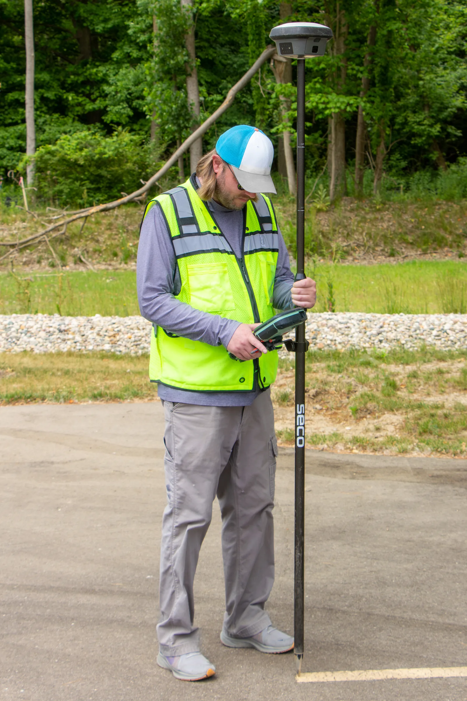 Jacob Wysko (SweetCanadianMullet), via Wikimedia Commons, CC BY 4.0
Add ground control points surveyed with an RTK rover or total station, and you constrain the photogrammetric bundle adjustment to known ground coordinates. The model stops floating. Systematic errors — base station misplacement, antenna offset, atmospheric delay — get absorbed by the adjustment.
The accuracy jump: James et al. (2017) in Geomorphology demonstrated that adding 5 well-distributed GCPs reduced vertical RMSE from 4.2 cm (RTK-only) to 1.8 cm — a 57% improvement. Sanz-Ablanedo et al. (2018) found similar results: 5 GCPs brought vertical accuracy to sub-2 cm on sites up to 50 hectares. The improvement is most dramatic in the vertical axis, where systematic errors accumulate.
Distribution matters more than count. Five GCPs spread across the perimeter and one in the center outperform twelve clustered in one corner. For details on GCP placement strategy, see Ground Control Points for Drone Surveys: How Many, Where, and Why.
When Tier 3 is enough:
- Design-grade topographic surveys. Civil engineers using your surface model for earthwork calculations, drainage design, or grading plans.
- Boundary and area measurement where the client uses your map to verify fence lines, setbacks, or acreage for transactions.
- Permit-required surveys. Many municipal and state agencies require GCP-constrained drone deliverables for floodplain, stormwater, or land disturbance permits.
- Any project where someone else validates your work. A surveyor reviewing your deliverable will look for GCPs in the report. No GCPs, no credibility.
When Tier 3 falls short: When the deliverable is legally binding, when ASPRS formal accuracy certification is required, or when the project demands documented, independent validation — not just GCP fit statistics. Tier 3 proves your model fits your own control. It doesn’t prove real-world accuracy unless you withhold some points as independent checks.
Cost reality: Add 1 to 3 hours of field time for GCP placement and survey. A survey-grade RTK rover (Emlid RS3 at $2,999, Trimble R12i at $15,000+) is required for the ground measurement. If you’re subcontracting the survey, expect $500 to $1,500 per mobilization depending on site size and number of points.
Tier 4: RTK/PPK + GCPs + Independent Checkpoints (Maximum Defensible)
This is the full stack. You fly RTK or PPK for corrected camera positions. You set GCPs for bundle adjustment constraint. And you place additional survey points — checkpoints — that you deliberately withhold from processing. After the model is built, you compare your drone-derived coordinates at those checkpoint locations against the surveyed ground truth.
That comparison produces your real-world accuracy number. Not the software’s internal fit. Not your RTK fix quality. The actual, independently validated, defensible accuracy of the deliverable.
The numbers: With a clean RTK/PPK flight, 5+ GCPs, and 5+ independent checkpoints, expect 1 to 3 cm horizontal and 2 to 4 cm vertical RMSE on flat to moderate terrain. Sub-inch. Provably.
ASPRS Edition 2 (2023) sets the minimum at 30 independent checkpoints for formal accuracy testing, scaling up to 120 checkpoints for very large project areas (the standard keys checkpoint count to project area in km², not acres). USACE requires independent QC points on any photogrammetric mapping deliverable used for engineering design or construction.
When Tier 4 is required:
- Legal surveys and boundary work where the deliverable may be entered as evidence.
- ASPRS-certified accuracy reports for government contracts, FEMA floodplain mapping, or DOT projects.
- USACE engineering design — dams, levees, channels, anything where lives depend on the survey.
- Cadastral and land title work in jurisdictions that accept photogrammetric deliverables.
- Any project where “how do you know?” requires a number, not a narrative.
When Tier 4 is overkill: Construction progress monitoring to 0.3-foot tolerance. Agricultural surveys. Volumetric estimates. Marketing imagery. Site reconnaissance. Most private-sector commercial drone work.
Cost reality: Full mobilization including RTK flight, GCP placement, survey of GCPs and checkpoints, post-processing, and accuracy report generation. Budget 6 to 8 hours of field time and 2 to 4 hours of office time per project. This is the most expensive tier — but it’s the only one that produces a legally defensible accuracy statement.
The Decision Flowchart
Start with the project specification. Not your equipment. Not your comfort level. The spec.
Step 1: What accuracy does the project require?
- No measurement from the deliverable — Tier 1
- Measurement to 0.1 ft (1.2 in) or looser — Tier 2
- Measurement to 0.05 ft (0.6 in) or engineering design use — Tier 3
- Legal, regulatory, or ASPRS-certified — Tier 4
Step 2: Does anyone need to independently validate accuracy?
- No — stay at your current tier
- Yes — move to Tier 3 minimum, Tier 4 if formal certification required
Step 3: What are the consequences of being wrong?
- Redo the flight — Tier 1 or 2
- Redo the design — Tier 3
- Litigation, permit denial, or safety failure — Tier 4
If two steps point to different tiers, go with the higher one. You can always downgrade on the next project. You can’t upgrade a deliverable after the fact — once you’ve left the site without GCPs, the data is what it is.

When to Upgrade Tiers
The most common mistake is locking into one tier and applying it to every project. The second most common mistake is never upgrading when the project demands it.
Upgrade from Tier 1 to Tier 2 when you start measuring from the deliverable — distances, areas, volumes, elevations. Consumer GPS accuracy means your measurements carry 1–3 meters of embedded error. That’s fine for relative comparison. It’s not fine for billing or design.
Upgrade from Tier 2 to Tier 3 when the deliverable goes to a licensed professional — surveyor, engineer, architect — who will use it in their work product. They need to see GCPs in your processing report. They need to know the model was constrained to ground truth, not just corrected antenna positions.
Upgrade from Tier 3 to Tier 4 when the deliverable is the record of truth. Legal proceedings, regulatory submittals, FEMA mapping, DOT design. If someone can challenge your accuracy claim and the consequence is more than a redo flight, you need checkpoints.
Downgrade when the project doesn’t need it. Running Tier 4 on a monthly stockpile volume check is a $3,000 solution to a $500 problem. The professional move is knowing when less is enough.

The Real Cost of Getting the Tier Wrong
Over-engineering costs time and money. Under-engineering costs credibility and potentially your client relationship.
I’ve seen both. An operator running Tier 4 on every job regardless of spec — burning 8 hours in the field on sites that needed 3. His per-project margin was thin because he was treating stockpile monitoring like FEMA mapping. Good work. Wrong tier.
I’ve also seen an operator deliver a Tier 2 product on a project that needed Tier 3. The civil engineer overlaid the drone surface on his design and found a 4-centimeter systematic vertical shift — well within Tier 2 spec, but outside the design tolerance. The entire surface had to be re-flown with GCPs. The client didn’t call back.
The framework is simple: read the spec, pick the tier, execute it well. If there’s no written spec, ask the client what they’re using the deliverable for — then pick the tier that matches the use case.
To put it plainly: accuracy isn’t a single standard you always hit. It’s a range you select based on the job. The professional knows all four tiers and deploys the right one.
Bottom Line
Not every drone survey needs ground control points. Not every project justifies RTK hardware. And not every client needs sub-inch defensible accuracy with independent checkpoint validation.
Most commercial drone work lives in Tier 2 — RTK or PPK without GCPs, 1 to 2 inches, fast and cost-effective. Tier 3 adds GCPs when the deliverable goes to an engineer or meets a regulatory requirement. Tier 4 is the full stack for legal and certified work.
The framework isn’t about cutting corners. It’s about matching the tool to the job. A Tier 2 survey executed well on the right project is more professional than a Tier 4 survey sold to a client who didn’t need it.
Know your tiers. Read the spec. Deliver accordingly.
For more on positioning methods, see RTK vs PPK Drone Mapping: Which Should You Use?. For GCP strategy and placement, see Ground Control Points for Drone Surveys. For understanding accuracy metrics, see Drone Survey Accuracy: What the Numbers Actually Mean.